Saturday, 13 December 2014

Australia's second highest mountain

In my last post I promised that I will send a photo looking from the main range down the western fall to Geehi, as soon as the weather was good enough to get up there. I had to wait just over a week, during which it rained on and off and there was low hanging cloud, which restricted my walking to the lower areas of Thredbo. I managed to walk from the village up to the top on three different days, taking a different route each time. Yesterday I finally woke up to cloudless skies. After my daily intake of weet-bix I had a coffee on my balcony for a final weather-check before heading out.

Weather check from my balcony, not a cloud in sight!
I got to the bottom station of the chairlift just before 8.30, when I thought they would open. Unfortunately I was a bit over-enthusiastic, the lift doesn't open to the public until 9 AM, so if you plan to set out early for a walk in the main range you either need to walk to the top, or drive across to Charlotte's Pass. I spent the half hour soaking up the morning sun and watching the lift crew getting the chairs racked on to the lift.

Bottom, middle and top of the chairlift journey
For those of you that are not familiar with the Australian Alps, Mt Kosciuszko is the highest mountain in Australia. Even though the chairlift in Thredbo is called the "Kosciuszko Express" it doesn't actually go up it, but it takes about 600 vertical metres out of your journey to it. From the top of the chairlift there is an undulating walk to Rawsons Pass and from there you ascend to the actual Mt. Kosciusko. The walk between the top station and the foot of Mt. Kosciusko is about 5 kilometres, most of it raised on metal grids, which have a pleasant bounce that adds a spring to your step.

The iron walk way, with a first glimpse of Mt. Kosciuszko (the middle one)

The raised walk way prevents erosion by the thousands of people who conquer Kosciuszko each year. It seems to work very well and you can enjoy unspoilt alpine flora all along the way; during December and January there are many wild flowers in bloom. About half way along the path crosses the headwaters of the Snowy River. If you have been following my blog, this is the river along which I drove down to the coast when I first started my trip around Australia, so I have now seen it in all stages of its being.

A pretty brook

Turns into a powerful mountain stream

Calming down near the coast

Just before you get to Rawsons Pass at the foot of Mt Kosciuszko you can see Lake Cootapatamba, which is the highest lake in Australia and one of only a handful of glacial lakes on the continent. 

Lake Cootapatamba at the foot of Mt Kosciusko
Once you get to Rawsons Pass you can take advantage of Australia's highest toilets, which have been built since I was up here last. Given the popularity of Mt Kosciuszko as a tourist destination it makes sense to provide facilities so that people don't get caught out and have to step behind a rock, because there are no trees up here. 

I actually walked up Mt. Kosciusko only three days before this walk, on a grey rainy day, more for the exercise than the views. Yesterday my goal was first and foremost to go and take a picture of the western slopes, so I turned off the summit road, along the main range track, towards Muellers Pass with a plan to ultimately reach Mt Townsend, Australia's second highest peak.

I turned right along the Main Range Track
I last walked up to Mt Townsend 22 years ago, when some friends wanted to paraglide down the western falls. I remembered that the track skirts around the south western flank of Mueller's Peak. Walking down the main range track to Mueller's pass I could make out the track in the distance, but once I got down to the pass there wasn't a discernible beginning. So I walked up the hill from the pass a little bit and then cut to the left, slightly downhill in the hope to meet the track further along. It worked and only couple of hundred metres in I found a small, but well recognisable track. It is easy to follow, until you get to a rocky ravine about half way across the flank of Mueller's peak. From there the track is marked with small stone cairns on the rocks. 

There should be a track to the left somewhere here...

That's what it looks like once you find it

Can you see the cairn marking the track?

I got to the little plateau at the foot of Mt Townsend after about 2 1/2 hours walking from the top of the chairlift. From here to the Summit you have to scramble across rocks. If that is not your thing, you can minimise the climbing and skirt around the peak, still getting great views in all different directions.

The summit of Mt Townsend

The view down the western fall. The grassy area in the back is Geehi,
only 8 km away, but 1700 metres lower

The view east, across to Mt. Kosciuszko
Before heading back I took a little detour towards Alice Rawson Peak. This is definitely worthwhile for the views of Lake Albina and Watsons Crags, where the Main Range looks its most rugged. 

Lake Albina
Watsons Crags
On the way back I somehow missed the track and got a bit too far down into Wilkinsons Valley between Mt. Townsend and Mt Kosciusko. On a sunny day with clear visibility that is no drama, as you are never really lost, there are plenty of visible landmarks, and I simply headed towards Mueller's peak until I picked up the track again. I took a panoramic picture from Wilkinsons Valley that includes Kosciuszko and Townsend. It didn't turn out very well, but the reason I mention it is that back on the main range track there was a wedgetail eagle soaring only about 50 metres directly above me. I reached for the camera, turned it on and it started preparing itself for another panoramic picture.... by the time I changed the setting the eagle was gone, so sorry, no picture of rare birds!

Once I reached the summit road I figured that to round off my blog post for you I might as well take a picture of Mt Townsend from Mt Kosciuszko, so I turned right and walked up to the summit. As can be expected on a perfect day, there were crowds gathering, almost queuing to take their selfie with the trig marker as proof that they conquered Mt. Kosciuszko. I only stayed long enough to get the opportunity of taking a picture of Townsend without someone standing in front of it and then headed back to Thredbo.

Kosciuszko Summit

Mt Townsend from the summit

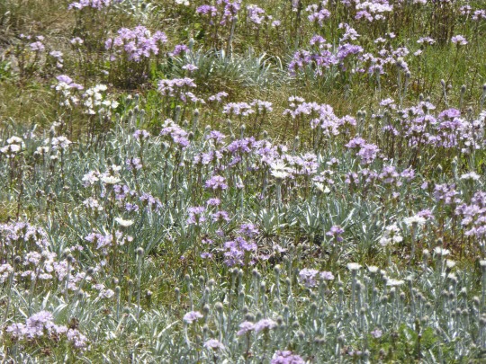
To finish this post I want to show you some of the alpine flowers that you can expect this time of year and a picture of the Ramshead Range, which is my next project for an alpine ramble.
Billy Button

A field of wild flowers

The Ramshead Range (4th highest in Australia)


Friday, 5 December 2014

The loop is closed!

I have been remiss in updating my blog over the last week, because I was busy closing the loop around Australia. I arrived in Thredbo two days ago and have moved into my new apartment. Because it was empty for a couple of months it needed a lot of dust and cob web removal, which gave me a good opportunity to test my new Miele vacuum cleaner. Now I just need to pick up the stuff that I shipped from the UK, which includes a bunch of paintings to go on the walls. But I am getting ahead of myself, let me tell you a bit more about the last part of my drive.


The path that I followed from Torquay, from where I posted my last report, was determined by friends that I wanted to visit. First I drove to Croydon, which is an outer suburb of Melbourne where a friend of mine dwells on a large, but steep block of land. I got there on Saturday morning and he took me around to another friend's place for brunch. The suburbs around Croydon are very established and have some nice houses in leafy gardens. The drive into the City takes about 25 minutes on a weekend, but is probably significantly longer in business traffic. About 20 minutes in the other direction you get to the Yarra Valley, which is a wine region and an easy to reach recreational area for Melbournians. To keep up my daily step count we went for a 15 K walk along the Lilydale to Warburton rail trail. It follows the old railway line and as such doesn't have any steep hills. Despite the hot temperatures the walk was very pleasant and there are water bottle refill stations along the way and keep up your moisture content.

Lilydale to Warburton Trail

A white horse under a tree (for all my friends with teenage daughters)

From Croydon I headed across the Black Spur to Alexandra, where another couple of friends, whom I haven't seen for 10 years, made their home. The drive over the Black Spur is very pretty, leading through forests of tall mountain ash and fern trees.

The road over the Black Spur

Outdoor education is one of the main industries of Alexandra and the couple of friends I stayed with make their living from it. They have a fantastic house set on an acre of gardens, with an entertainment area, complete with self-built pizza oven, which they fired up in my honour. Getting a pizza oven up to full heat takes about three hours, which means that you need to start mid-afternoon and attend to it diligently, adding wood and stoking the fire. Naturally this is a job that needs to be accompanied by beer drinking. I volunteered to assist in the proceedings...
The pizzas were fantastic and we managed to eat, drink, chat and be entertained until way past midnight. One of my hosts, with whom I worked on the mountain in Thredbo 20 years ago, has taught himself to play the ukulele and guitar to a very high standard.

The next day we drove into a nearby town called Mansfield, where an ex-employer of ours now owns a coffee shop and a pub. The coffee shop, called the Mansfield Regional Produce Store, was absolutely packed with people eating and drinking. The clientèle was very much what you would expect to see in the inner city, rather than in a country town. Apparently there are a lot of ex-city dwellers in the area, living on small farms after what they call "a tree change". The pub was less busy and will probably be a bit more of a challenge. They acquired it only recently and it will take a lot of work to bring it into the same class of establishment as the coffee shop. 

The Produce Store, worth a stopover for a coffee and home made cake
In the afternoon I went for a walk in the Cathedral Range State Park. There are many signed walks on offer, right up to the summit of Cathedral Mountain, but I only took a small loop walk in the bottom of the valley. It was pleasantly cool, walking through dense vegetation along a creek. I looked for platypus, but couldn't spot any.

Platypus country, but I didn't spot any
My friends gave me some tips on a route to take from Alexandra through the Victorian Alps up to Thredbo. I heeded their advice and set out the next morning in direction of the Mitta Mitta valley. To start with I drove to Mansfield and then across a small mountain range into the King Valley, yet another wine region. The first town I got to was called Whitfield. From there the road heads north-west to Wangaratta, but, since I wanted to head towards the east, that looked like a detour to me. My camping book showed a direct route from Whitfield to a town called Myrtleford, which is directly east. It took me a few attempts to find the road, which is more of a gravel track, but easily passable, even without a four wheel drive. The only hazard to look out for along the way are logging trucks, which came at speeds that wouldn't allow them to stop if you get in their way. The gravel road wound itself through very pretty hills and valleys until it reached the Buffalo River. There it turned into a sealed road again for the last thirty kilometres to Myrtleford.

Along the direct route from Whitfield to Myrtleford
At Myrtleford it joined The Great Alpine Road, which leads from Wangaratta, in the north of Victoria, to Metung on the south-east coast. The stretch that I drove led through Bright, up to Mt Hotham and then down to Omeo. The views from Mt. Hotham across the Victorian Alps are spectacular, as is the road heading up to it.

The view from Mt Hotham to Mt Buffalo (right in the back)

View of Omeo down along the descent from Mt Hotham via Dinner Plains
In Omeo there was a road sign "Mitta Mitta 99 km". I thought that I would get there in a good hour or so. Little did I know that the Omeo Highway, as the road is called, is one of bendiest roads that I have ever driven. It took me 2 hours and 15 minutes to get to Mitta Mitta. In the beginning I enjoyed the steep cliffs running along pristine rivers, but about an hour into the drive I was craving a straight bit of road. I actually began to get road sick, which has rarely happened before when I was driving myself. By the time I got to my destination I was exhausted. It turned out that this day was the longest drive that I did on my whole journey, despite it being one of the shorter legs.

<no pictures of Mitta Mitta, I was too buggered to take any>

The next morning I drove into Albury/Wodonga a couple of joined up towns on the NSW/Victorian Border. I went there for the purpose of acquiring some electronics. I needed a TV and a printer for my new apartment. After getting a couple of bargains I started to head towards Thredbo. My plan was to camp at the Geehi Flats, which is an old grazing area south of Thredbo along the Alpine Way. But before that I wanted to do a walk to get the long drive from the previous day out of my system. I stopped at Huon, on the shores of the Hume Weir, and walked along the High Country Rail Trail. My plan was to walk to the 600 metre long bridge over Sandy Creek and back. Unfortunately heavy rain set in about 45 minutes into my walk, so I turned around and drove on. I stopped again closer to the bridge and walked to it from there, so I can bring you a picture. The bridge was only recently renovated and has a rather modern look and feel. Further along the road towards Corryong you can visit an original old trestle bridge over Boggy Creek, only about 500 metres walk from the road.

The renovated bridge over Sandy Creek

The old bridge over Boggy Creek
Because the rain persisted all day long and my appointment to take over the keys for my apartment was the next morning I decided to stay in motel. I selected the Alpine Inn in Khancoban, the last town before my intended camping spot. I went to the bar for some dinner and found that an old acquaintance from Thredbo was the cook. The food was simple, but wholesome, just what I needed after a day in the rain. I was glad that I stayed at the inn, because at about 1 o'clock in the morning there was an almighty thunderstorm, not something that I would fancy staying in a tent.

The last stretch from Khancoban to Thredbo leads along the Alpine Way. It crosses a couple of spurs until you get to Geehi Flats and from there it climbs up to Dead Horse Gap, it's highest point. The southern falls of the Snowy Mountains are much more spectacular than the northern approaches, which are a lot more gradual. From Mt. Townsend to Geehi Flats is a distance of 8 km, with a drop of 1700 metres (5100 ft. for my American friends). I remember walking out to Mt. Townsend with some friends who then paraglided down to the flats. The weather on the day of my drive was still wet, with low clouds, so I can't show you any pictures. I promise I will walk out to Mt Townsend in the near future and will post some pictures looking down to Geehi from above. 
Murray 1 Power Station between Khancoban and Geehi

Mist rising from the Murray Valley

Geehi Hut (renovated after the 2003 bush fires) 
The river Murray at Tom Groggin, I crossed it by car ferry in
South Australia a couple of weeks back

Not far from home, the highest point on the Alpine Way

Thredbo has given me a wet welcome. We had heavy thunderstorms for the last couple of days. Today I walked up to the top of the chairlift and back and got a good soaking. Luckily my new apartment has a drying cupboard.

Thunder clouds building up over Thredbo
Now that my drive is finished I am not sure how regularly I will update my blog. I hope that there will be plenty happening that is worth reporting and I will certainly post some pictures of the walks that I plan to do. But for now I will curl up on my couch, watch the rain and read a book.


Friday, 28 November 2014

Great Ocean Road

Today I drove the Great Ocean Road for the second time. Last time was together with my then wife, about 10 years ago, when we drove it east to west. Today I drove it in the reverse direction, which actually does matter. Let me explain: 

The drive can be broken up into three different sections: The westerly section where you will get limestone feature overload, the middle section where it leads across the green hills of Cape Otway and the easterly section where the road is carved into the cliffs and the drive itself becomes the attraction. It is on this last section where you are better off if you drive east to west because you are on the ocean side, where all the lookouts are. It is almost impossible to get to them if you drive in an easterly direction. I also suggest that, if you have never driven it before, you take two days and break at Cape Otway. There are some nice walks to be had in the Cape Otway National Park and it also gives you more time to look at the many different sights on the westerly section.

Coming from the west, on the first part of the drive I felt like a postman. There are so many lookouts and sights that you rarely drive more than a kilometre or so before you get out of the car again to look at some coastal feature. The coast is limestone and, as we know by now, this weathers into spectacular shapes, so all along this section you will be presented with different formations of arches, pillars, islands and gorges. Of course they all have fancy names like the Bay of Martyrs, Twelve Apostles, Razorback, London Bridge etc, probably named by the tourist board, rather than the early explorers who were much more literal and would have called them Bay of Rocks, Rock Pillars and Holey Rock, or Blandings Bay, after some English aristocrat. The one thing that all these attractions have in common is that you will share them with lots of other people. The Great Ocean Road is a major tourist attraction and easy to reach in a day from Melbourne. You will also soon learn that the tourist dollars are resolutely delivered to us on the right hand side of walk ways... Luckily each car park exit has a large sign "In Australia we drive on the left!", so the danger of collisions on the road is less than on the footpaths.

Arches

Islands
Pillars

People
Cape Otway is my favourite part of the Great Ocean Road. The road climbs high into green hills and pastures. The drive from the road to the cape is about 12 kilometres and leads through dense forest. On the cape itself there is a lighthouse and the old lighthouse keepers cottages, where we stayed overnight on our last trip. Today I didn't get close to the lighthouse because they fenced it all off and wanted $20 entry fee. So I took a walk up to a lookout instead, which is why you only get a far away view of the light house. What was far more pleasing for me is that I saw my first koala in the wild. Not only one, but several, it was koala city out there! About 2 km from the tip of the cape is a forest of Manna Eucalyptus, which they like to eat. I always thought that koalas mainly sleep because they are permanently stoned from the toxins in the leaves, but they were quite active, climbing around to find the juiciest foliage.

My first wild koala sighting 
 
Cape Otway Lighthouse
From Cape Otway the road then descends back to the beach at a town called Apollo Bay, and from there it follows the coast very closely along beaches and carved into cliffs. There are some spectacular sections. This part of the drive is as windy, or even more so, than the hill section, so you won't be able to drive very fast. As I mentioned before, here the Great Ocean Road itself is the attraction, more so than the coastal features. Albeit, along the way you will get to some small towns that look like nice places to spend a few days on a beach holiday.

Along the descent from Cape Otway

And then the road becomes the main attraction
Tomorrow I will head into Melbourne's suburbs to catch up with a ski bum friend who I haven't seen for many years. After that I will head through the Victorian high country towards Thredbo, where the loop around Australia will close. Let me finish today's post with a short video of a young koala taking a leap:


Thursday, 27 November 2014

Entering Victoria

No, not what you think with your dirty mind! 

Today is my birthday and I just arrived in Warnambool in the state of Victoria, where I am staying in a rather posh hotel at a cost of less than my basic room cost me in the Nullarbor; a good example of supply and demand...

Yesterday I drove from Victor Harbor to Robe. The satellite navigation system in my car wanted me to backtrack to the A1, which I chose to ignore because that's where I came from. Instead I just followed a minor coast road in an easterly direction, first to Goolwa and then to a place called Milang, which is on Lake Alexandrina. The lake is rather big and forms part of the delta of the mighty river Murray. I had to circumnavigate the lake to get to a town called Wellington, where there was a river crossing. Little did I know that there wasn't a bridge, but a ferry, an extra treat! I waited to drive onto the ferry together with only one other car and was fully prepared not to pay until it gets me to the other side (you see, I learned my life skills from pop songs), but to my great surprise the service was free. 

So ferry across the Murray
'cause this land's the place I love...


After the crossing, with Gerry and the Pacemakers on my mind, I stuck to my plan and kept close to the coast. The road followed the Coorong for over 100 kilometres. The Coorong is a lagoon separated from the sea by a very long bank of sand dunes, and is meant to be a paradise for sea birds. It was OK for a while, but the further south I drove the more it started to stink. I later did an Internet search for "Coorong stinks" and found out that there is a problem with the Murray river not carrying enough water to flush out the Coorong and that it's salt levels are now more than four time that of the ocean beyond, which leads to it dying off. I guess this could be a side effect of the Murray Darling Irrigation Scheme.

The Coorong stretches for over 100 km along the coast
I arrived in Robe around lunch time. It is a small town, still in South Australia, with a nice little harbour from which they run a fleet of crayfish boats. I took a walk along the foreshore around the harbour and around Cape Dombey, on which stands a large obelisk. It was put there in the mid nineteenth century as a marker for ships and to house rockets that they used to fire rescue equipment to ships in distress. Cape Dombey was first named Cape Lanne by our good old friend Nicholas Baudin, but was soon after renamed by our other friend Matthew Flinders. At least Flinders named the rocks out in the sea off Robe "Baudin Rocks" and the bay on which Robe is situated "Guichen Bay" after a French admiral. 

The obelisk at Cape Dombey. It took 32 oxen to pull it there!
The walk around the cape takes you to the modern lighthouse, which to me looked a lot less appealing, but I must congratulate the designers for being brave enough to break with tradition. After the view of the new lighthouse I took a loop track back, which took me to the ruins of the old Robe Gaol, which isn't much to behold. Much more interesting is the old customs house, which is now home to a small museum that explains the history of Robe. I think the the most interesting event happened in the years of 1856 to 1858, when over 14,000 Chinese arrived in Robe and from here walked over 300 kilometres to the Victorian gold fields. They were forced to do so by the Victorian Government introducing a £10 tax on any Chinese arriving in a Victorian port.

The old customs house, now a small museum

Modern lighthouse design
Directly opposite the customs house is a memorial for all the ships that got wrecked along the coast. It also displays busts of Captain Flinders and Sub-Lieutenant Baudin (I mistakenly made him a captain too in earlier posts), so we can finally put a face to their names.

Flinders and Baudin
This morning I left Robe at half past seven and kept going along the coast towards Warnambool in Victoria. After a couple of hours of driving I saw a tourist sign "Seal Colony" and, because I like seals, followed it. A small winding road took me to a very small town called "Cape Bridgewater". I parked my car and found a sign that told me that it was a 2.5 km walk to the seal colony, just over the cliffs. The walk was absolutely delightful. It lead along cliffs that were very reminiscent of the coastal walk in Cornwall in the UK, with grazing land abutting the cliffs and soft grass underfoot. The walk first led down to the sea, where you could take a boat trip to see the seal colony, and from there up the highest cliff in Victoria, 135 metres above sea level. Once the highest point is crossed it then leads straight ahead to the tip of the cape. There are two seal colonies, an Australian fur seal colony and a New Zealand fur seal colony. They ozzies are to the left of the cape, the kiwis to the right, they don't mix! There is a good lookout to watch the Australian colony, and a smaller one for the New Zealand fur seals, where you have to crane your neck a bit to see them. When I walked along the Cape's southern edge to try and find a better vantage point I came across a large mob of kangaroos hiding in the bushes.

The walk goes all along these cliffs to the tip of the cape

Australian fur seals

The track reminded me of Cornwall...

...but there the bushes don't have heads
The lush eastern side of the cape is formed from volcanic rocks, whereas the western side is limestone, which is a total contrast. There is not grass here at all, but some spectacular rock formations, which are called "the petrified forest" because they look like tree trunks, but apparently they are purely a geological phenomenon.

The petrified forrest

From Cape Bridgewater it was still about 100 km to Warnambool. Along the way I stopped off at a place called Port Fairy, intrigued by its name. It is an old town with over 50 listed buildings and a small harbour, which is protected by Griffiths Island. There is a 3 km walk around the Island, which was just right for a little afternoon exercise. The island is a bird sanctuary, so you need to stick to the track. If you walk the track clockwise, the first kilometre or so leads to a lighthouse on a well maintained track suitable for wheelchairs and prams. After that the track leads along the seaward side of the island through the dunes and along the beaches. The island is formed from black lava rock, which provide a great contrast to the green vegetation and the blue sea. The walk only takes just over 1/2 hour and is definitely worthwhile.

Griffiths Island lighthouse at Port Fairy

Black lava rocks

All up I walked just over 16,000 steps today, which means that I can indulge in a birthday dinner. Tomorrow I will drive the Great Ocean Road to Torquay. 

I will follow the lead of this Pied Oyster Catcher on Griffiths Island
 and go looking for some seafood!